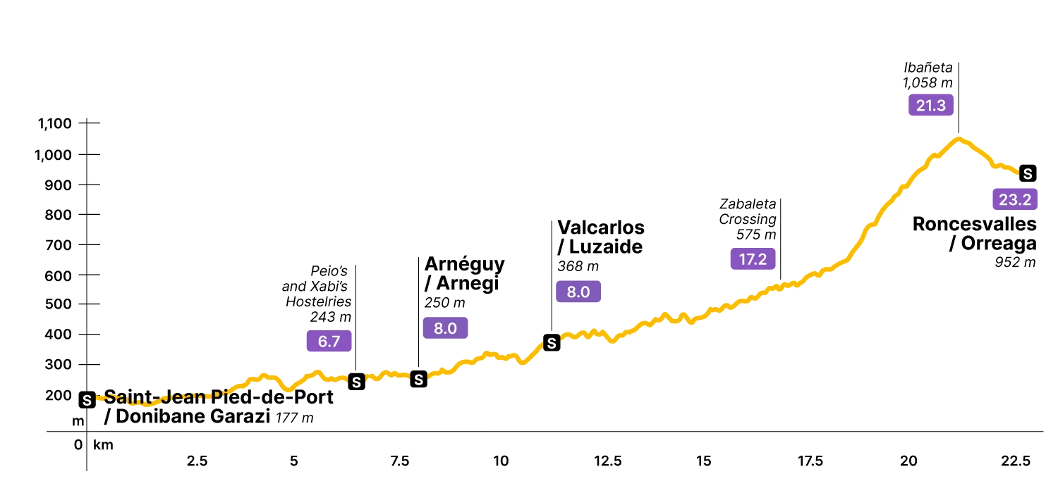
Stage Data 23.2 km · +1,489 m
In short
The Valcarlos variant reaches Roncesvalles through the valley of Arnéguy / Arnegi, skirting the high passes entirely — no Bentartea, no Lepoeder, none of the exposed ridge that defines the Napoleon Route. What it offers instead is a longer valley walk with a more gradual climb to Ibañeta, and more places to stop along the way.
It's also the mandatory route between November 1 and March 1, when the Napoleon / Cize pass closes. The mountain shuts. This one stays open.
If you want to see the stage through the Cize passes, read here.
Step by step
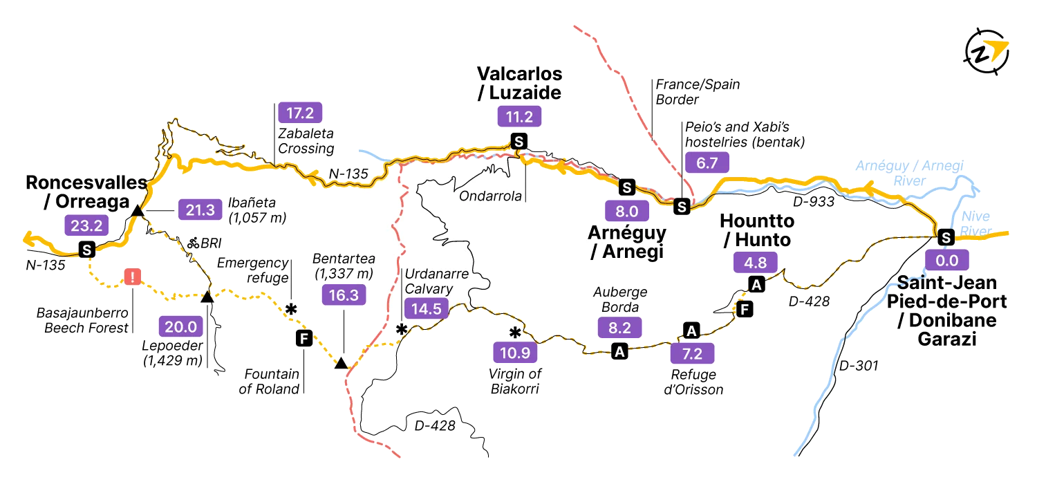
Start at the Porte d’Espagne 0.0, where the two routes split. The Napoleon Route goes left. You go right, onto the D-933 — the Chemin de Mayorga — which becomes the N-135 once you cross into Spain.
The road follows the river Arnéguy / Arnegi (also called Aïri and Luzaide), crossing it several times from the start. The valley opens gradually between farmhouses (baserriak in Basque) and pasture, and the climbing begins in earnest only later.
At Peio’s and Xabi’s hostels 6.7— bentak in Basque — you’ll find a small commercial area and a petrol station on a bend right at the border. Useful, if you need it.
A little over a kilometre along a dirt track under chestnut trees brings you to Arnéguy / Arnegi 8.0, named for the river, with accommodation and a restaurant. A reasonable place to stop — the Ossau-Iraty sheep’s cheeses from this area are the real thing, if that matters to you.
From here, waymarks take you along the D-128 on the left bank of the river — quieter than the N-135, and closed to bikes. Three kilometres of this brings you to the hamlet of Ondarrola 11.0 (no services), and a short steep climb from the riverbank takes you into Valcarlos / Luzaide 11.2 at 370 metres. Accommodation, meals, a shop, an ATM — everything arranged along the N-135 that runs through the village.
From Valcarlos, the route stays close to the N-135, ducking onto dirt tracks and side roads before returning to the tarmac. Not the most scenic section, but it moves.
At the Zabaleta junction 17.2, you turn left onto a steeper track — about 4 kilometres of real climbing — to emerge at the Ibañeta Pass 21.3, also known as Roncevaux Pass, at the crest of the Pyrenees.
The Chanson de Roland locates a great battle somewhere near these passes. Armies crossed here. Pilgrims have been crossing here for a thousand years. Now it’s you, on a day that probably involved some coffee and a phone charger. The pass doesn’t register the difference — it just marks the boundary, as it always has.
At the foot of the modern chapel, you rejoin pilgrims coming down from the Cize passes — those who took the Napoleon Route but descended to Ibañeta rather than continuing through the Basajaunberro beech forest. From here, one shared descent of 1.4 kilometres brings everyone into Roncesvalles / Orreaga 23.2, entering from the north, alongside the walls of the collegiate church.
Lodging data for this stage is being added. Check back soon.
Field notes on the churches, ruins, monasteries and small museums along this stage. In preparation.